Challenge
Challenge
Optical satellites go blind under cloud, which is exactly when water managers most need soil moisture data. Irrigation verification and drought early warning both stall without a cloud-proof signal.
Approach
Approach
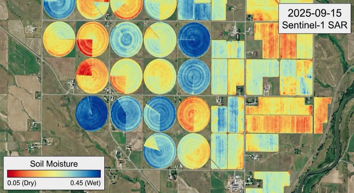
We fused Sentinel-1 radar backscatter with Sentinel-2 optical indices through the Water Cloud Model to remove the vegetation contribution and recover surface soil moisture. Time-series anomaly detection in Google Earth Engine flags irrigation events and drought onset.
Deliverables
What the client received
- Volumetric soil moisture maps independent of cloud cover
- Irrigation event detection from temporal moisture spikes
- Drought anomaly monitoring pipeline in Google Earth Engine
Outcome
Outcome
The retrieval resolves the full field range, from 0.45 m³/m³ under active center pivots to 0.05 m³/m³ in unirrigated corners, at field scale and on a fixed revisit. The method supports irrigation verification and drought early warning.
- 0.05-0.45
- m³/m³ moisture range resolved
- all-weather
- Radar sees through cloud
- field scale
- Per-pivot resolution