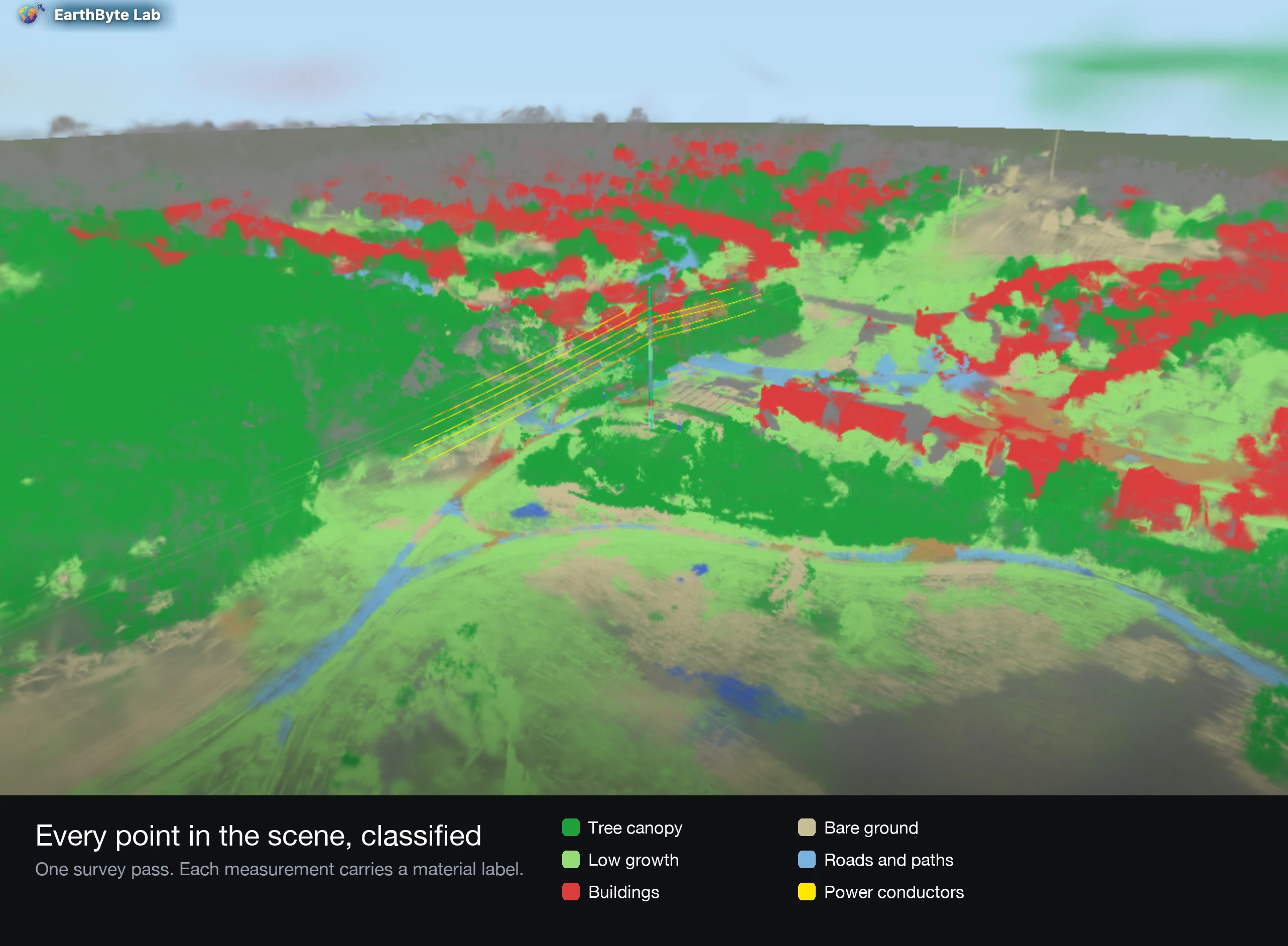
The world of Synthetic Aperture Radar (SAR) data has evolved significantly, providing high-resolution insights that were once out of reach due to the high costs of satellite imagery. Today, open-access SAR data from leading space agencies and commercial platforms is making these powerful tools accessible to everyone, from researchers and government agencies to businesses in various sectors.

In this blog post, we'll explore the open SAR data programs provided by platforms like Copernicus, USGS, Umbra, Capella Space, and others. We'll examine practical use cases in areas such as weather monitoring, agriculture, disaster management, and more, highlighting how these datasets can be leveraged to make smarter, more sustainable decisions.
1. Copernicus Sentinel-1
Availability:
The Sentinel-1 mission, part of the European Copernicus program, offers free and open access to SAR data. The mission provides C-band SAR imagery, which is ideal for global land monitoring, agricultural analysis, and disaster management.
Use Cases:
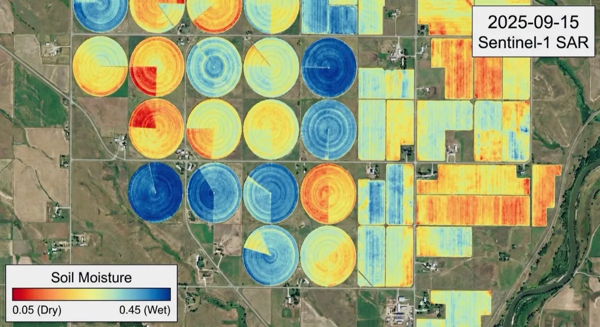
- Agriculture: Sentinel-1 data can be used to track crop health, soil moisture, and land use over time, helping farmers make informed decisions on irrigation, fertilization, and crop management.
- Disaster Management: Sentinel-1 can quickly assess flooding or earthquake damage, offering immediate, detailed insights that are critical in emergency response.
- Land Deformation: Monitoring changes in the earth’s surface, including subsidence and urban expansion, is another key application.
Access:
Copernicus Sentinal-1
2. USGS EarthExplorer
Availability:
USGS EarthExplorer offers free access to SAR datasets from ALOS PALSAR, Radarsat, and more. These datasets are valuable for scientific research and practical applications in agriculture, infrastructure monitoring, and climate studies.
Use Cases:
- Forest Monitoring: Detect changes in forest cover, deforestation, and health by tracking vegetation dynamics.
- Flood Mapping: EarthExplorer SAR data helps track flood extents and damage assessments, especially in remote or hard-to-reach areas.
- Glacier Dynamics: Observing the movement of glaciers, melt rates, and associated environmental impacts.
Access:
USGS EarthExplorer
3. NASA's Earth Science Data
Availability:
NASA provides SAR data from missions like ALOS PALSAR and NISAR (NASA-ISRO SAR Mission). These datasets are essential for understanding changes in land, water, and atmosphere.
Use Cases:
- Carbon Sequestration: Measuring vegetation density and structure to assess carbon storage in forests and soil.
- Weather and Atmospheric Monitoring: Detect sea surface winds, storm formation, and other atmospheric phenomena to support weather forecasting.
- Land Subsidence: Monitor the deformation of the earth’s surface caused by mining, drilling, or natural events.
Access:
NASA Earth Science Data
4. RADARSAT Constellation Mission (RCM)
Availability:
Canada’s RADARSAT Constellation Mission (RCM) provides C-band SAR data for a variety of applications, with some data available for public use, particularly for research and humanitarian purposes.
Use Cases:
- Agriculture: Monitor crop health, soil moisture, and irrigation needs, optimizing agricultural practices.
- Coastal Monitoring: Use RCM data to track coastal erosion and saltwater intrusion, critical for climate change adaptation and sustainable development.
- Oil Spill Detection: RCM data helps identify and track oil slicks on the ocean's surface.
Access:
Canadian Space Agency (CSA) Data
5. Umbra’s Open Data Program
Availability:
Umbra, a leading commercial provider of high-resolution X-band SAR data, offers an open data program to support research and humanitarian efforts. Their high-resolution imagery is available through limited access for academic projects and NGOs.
Use Cases:
- Infrastructure Monitoring: Monitor changes in urban infrastructure, such as bridges, roads, and buildings, for signs of deformation or damage.
- Environmental Monitoring: Track land use changes, deforestation, and monitor vegetation health.
- Disaster Response: Use SAR data to assess earthquake, flood, and landslide damage.
Access:
Umbra’s open data is available for specific projects. Check their website for more information on accessing their data: Umbra Open Data Program
6. Capella Space Open Data Program
Availability:
Capella Space, a commercial SAR provider, offers open data through their Capella Space Open Data Program. While the majority of their offerings are paid, they do provide free sample data and access to specific research datasets.
Use Cases:
- Agriculture: Use Capella’s high-resolution X-band SAR imagery to assess crop health, monitor irrigation needs, and optimize fertilization strategies.
- Urban Planning: Track land subsidence, construction activities, and urban expansion in rapidly growing cities.
- Disaster Management: After a natural disaster, Capella’s SAR data helps assess flood extents, earthquake damage, and landslide impacts.
Access:
Capella’s open data is available through their Open Data Program. For more information on accessing their data, visit Capella Space Open Data.
7. European Space Agency (ESA) Earth Observation Data
Availability:
The European Space Agency (ESA) provides free access to a variety of SAR datasets, including Sentinel-1, Envisat, and Earth Observation satellites, all part of their commitment to global open data.
Use Cases:
- Flood Monitoring: ESA’s SAR data is essential for flood mapping and disaster response, especially in regions prone to flooding.
- Coastal and Ocean Monitoring: Track coastal erosion, sea surface currents, and oil slicks using high-resolution SAR imagery.
- Environmental Monitoring: Monitor changes in vegetation, forest health, and land degradation.
Access:
ESA provides access to SAR data from missions like Sentinel-1 and other Earth Observation satellites. You can access their data through the ESA Earth Observation Data Portal.
Unlock the Potential of SAR Data with EarthByte Lab
Are you ready to leverage SAR data from open-access programs? At EarthByte Lab, we specialize in integrating these powerful datasets into your workflow, enabling data-driven and sustainable decision-making.
Whether you're monitoring agriculture, weather patterns, infrastructure, or disaster impacts, our expertise ensures you get the most out of SAR data. We offer:
- Data processing and analysis: We assist in accessing, processing, and analyzing SAR datasets to transform raw data into actionable insights.
- Custom analytical solutions: We build tailored solutions for specific use cases in agriculture, disaster management, infrastructure, and more.
- Seamless GIS platform integration: EarthByte Lab integrates SAR data into platforms like Google Earth Engine and QGIS to ensure a seamless experience.
- Consultation and Support: From data access to ongoing analysis, our team is here to support your projects every step of the way.
Let’s collaborate to transform your geospatial insights!
Contact us today to learn more about how we can help you utilize open SAR data for your projects, and visit us at earthbytelab.com and Schedule a consultation to get started!
Tagged