EarthByte Lab
Services
Markets
ProjectsInsightsAboutRequest a Proposal

EarthByte Lab

A geospatial technology firm. We turn satellite, LiDAR, and field data into decisions for utilities, agriculture, water, and infrastructure.

Michigan, USA · Serving clients nationwide

Services

  • Reality Capture & LiDAR
  • Satellite Analytics & Change Detection
  • Machine Learning & Predictive Modeling
  • Hyperspectral Data Analysis
  • Enterprise GIS & Applications
  • Advisory & Training

Markets

  • Utilities & Energy
  • Agriculture & Agribusiness
  • Water Resources
  • AEC & Infrastructure
  • Government & Emergency Management
  • Real Estate & Facilities

Company

  • Projects
  • Insights
  • Publications
  • About
  • Capability Statement
  • Careers
[email protected]

© 2026 EarthByte Lab LLC. All rights reserved.

From orbit to ground truth

Back to Insights

December 19, 2025 · 1 min read

Clouds Don't Matter Anymore: SAR-Based Soil Moisture Monitoring

Discover how EarthByte Lab uses Synthetic Aperture Radar (SAR) to monitor soil moisture through clouds, enabling precision agriculture, irrigation verification, and drought early warning systems.

By Sasmita Sahoo · Remote Sensing · Geospatial Analytics · Agriculture Technology

Clouds Don't Matter Anymore: SAR-Based Soil Moisture Monitoring

How do you map water content across a landscape when optical satellites are blocked by weather?

This is the biggest blind spot in agricultural monitoring. Soil moisture drives yield. Yet it remains the hardest variable to quantify spatially. We're solving this by moving beyond optical data.
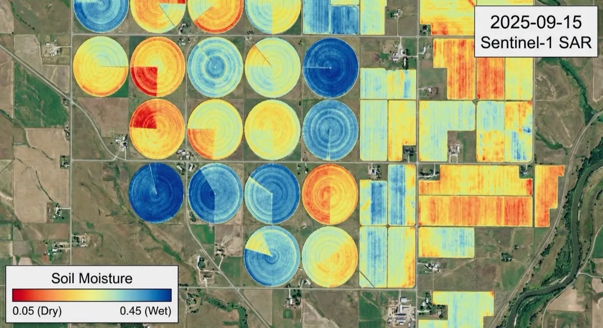
Soil Moisture SAR Analysis

What You're Seeing Here

This analysis from EarthByte Lab demonstrates our new operational capabilities for high-resolution soil moisture monitoring.

Those perfect circles? Center pivot irrigation systems.

Deep Blue: These areas indicate high volumetric water content near 0.45 m³/m³. The radar detects the wet soil instantly.

Red & Yellow: These are dry, unirrigated zones dropping to 0.05 m³/m³.

Going Beyond Static Maps

This isn't just a snapshot. We're now deploying advanced workflows that turn raw SAR backscatter into actionable hydrologic insight.

1. Seeing Through the Canopy

Radar signals often get confused by dense crop cover. We're overcoming this by fusing Sentinel-1 SAR with Sentinel-2 optical data. Using the Water Cloud Model, we mathematically "peel back" the vegetation layer to isolate the true soil signal underneath.

2. Irrigation Verification

Is it rain or is it irrigation? By analyzing temporal coherence and rapid moisture spikes, we can automatically detect irrigation events at the field scale. This is critical for verification and water rights compliance.

3. Drought Early Warning

We're not just looking at wetness—we're calculating anomalies. By processing years of historical backscatter in Google Earth Engine, we can identify deviations from the norm weeks before crop stress becomes visible to the naked eye.

The EarthByte Lab Advantage

We've shifted from sparse point measurements to continuous high-resolution monitoring. This is the intersection of hydrology and cloud computing. We can now optimize irrigation schedules and predict runoff with a precision that was previously impossible.

Ready to deploy these capabilities for your own assets? Book a consultation now

Contact us today to learn more about how we can help you utilize SAR data for soil moisture monitoring, and visit us at earthbytelab.com to get started!

Tagged

  • SAR
  • Soil Moisture
  • Sentinel-1
  • Sentinel-2
  • Google Earth Engine
  • Precision Agriculture
  • Water Cloud Model
  • Irrigation Monitoring
  • Drought Detection
  • Hydrology
  • Remote Sensing
  • Water Security

Keep reading

More field notes

Every Wire, Every Tree, Measured: Utility Corridor Inventory from a Single Flight

August 1, 2026 · 4 min read

Every Wire, Every Tree, Measured: Utility Corridor Inventory from a Single Flight

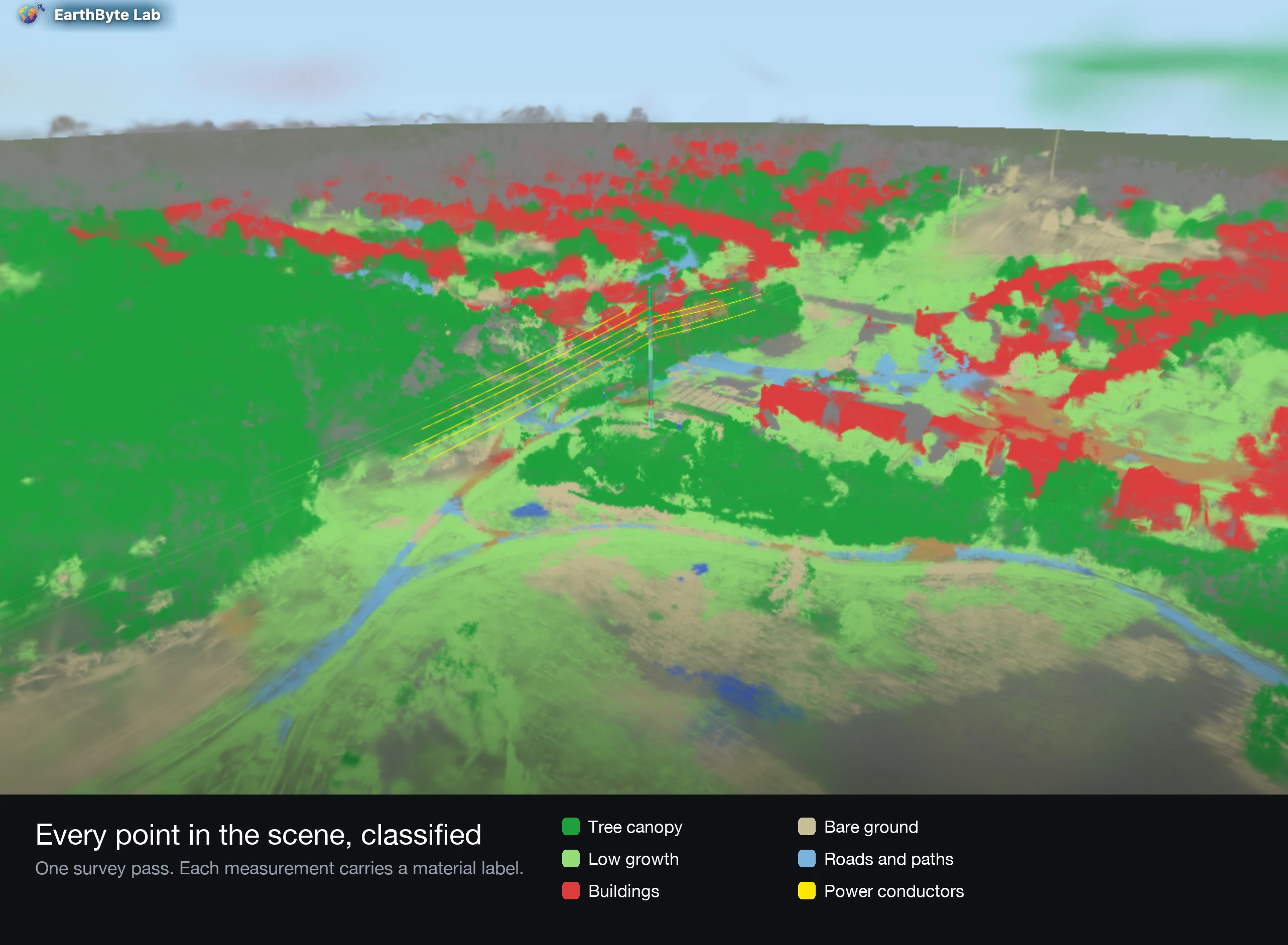
EarthByte Lab turns one aerial pass over a power corridor into a photoreal 3D record, a labelled asset inventory, and vegetation clearance measured in metres. No ground crew, no LiDAR truck.

  • 3D Gaussian Splatting
  • Utility Inspection
  • Vegetation Management
Read the post →
Leveraging Open SAR Data for Weather, Agriculture, and Geospatial Analysis

March 27, 2025 · 5 min read

Leveraging Open SAR Data for Weather, Agriculture, and Geospatial Analysis

Explore how open-access SAR data from Copernicus, USGS, Umbra, and Capella Space is revolutionizing weather monitoring, agriculture, and disaster management with high-resolution insights.

  • SAR Data
  • Weather
  • Agriculture
Read the post →
AI-Powered Weather Prediction: How Google's GenCast is Changing the Game

March 5, 2025 · 2 min read

AI-Powered Weather Prediction: How Google's GenCast is Changing the Game

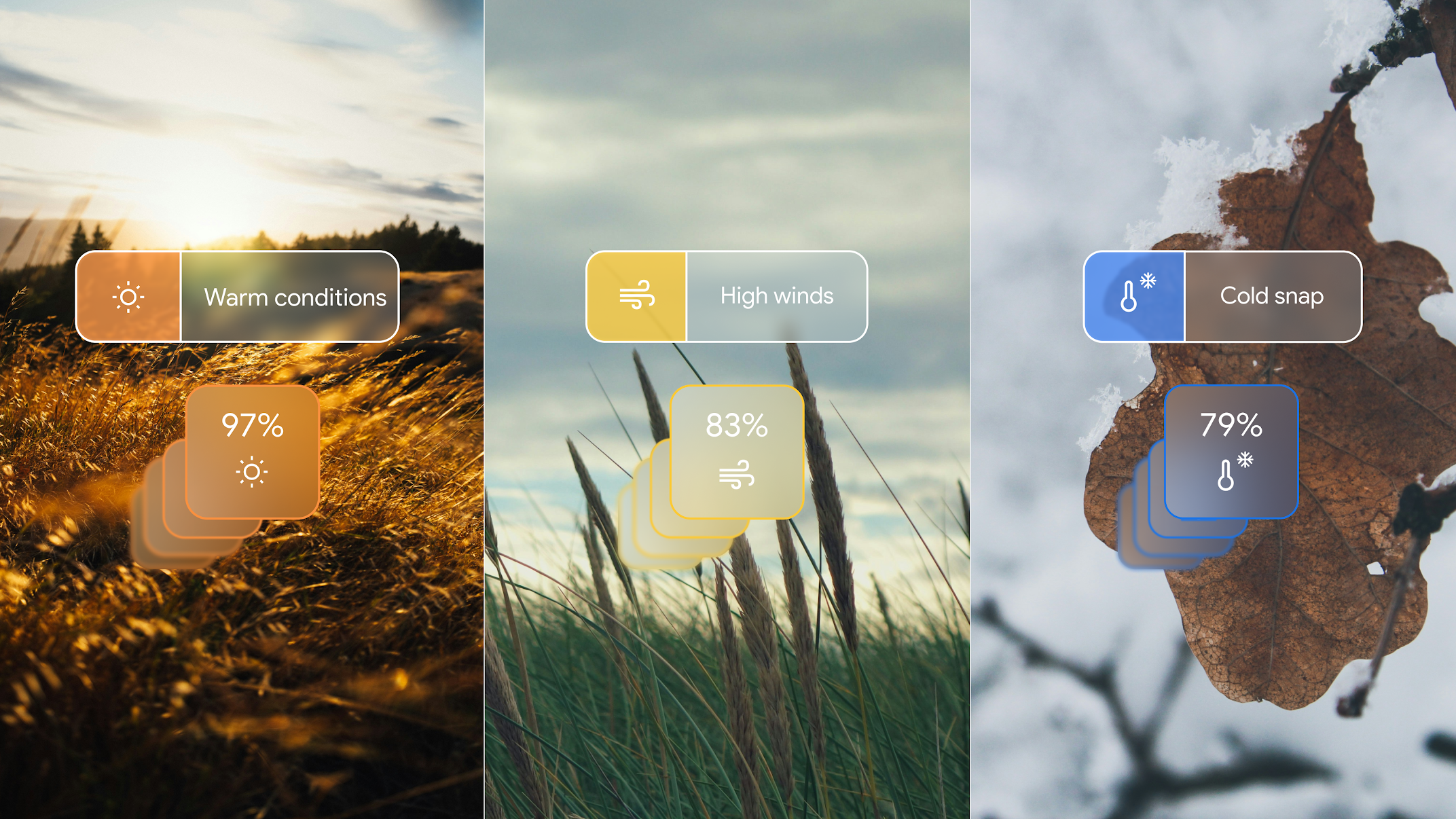
Google's GenCast uses generative AI to improve short-term weather forecasting. Learn how it benefits industries, researchers, and everyday users.

  • AI
  • Weather Forecasting
  • Google
Read the post →

Ready to Transform Your Geospatial Data?

Whether you're working on agriculture, climate resilience, or environmental monitoring, we're here to help you harness the power of geospatial technology.

Get in TouchRead More Posts